Hello

Previous Topic Next Topic
 
classic Classic list List threaded Threaded
2 messages Options
Reply | Threaded
Open this post in threaded view
|

Hello

Archaic
Howdy all, I'm giving LibreCAD a try as an alternative to AutoCAD 2000 which I no longer have access to.  I tried a few alternatives, but so far this feels the most familiar to me.  I'll probably have a lot of questions but for starters I have this one:

I am trying to use an aerial image as a base map that will have various data points shown (water wells, sample locations, drainage features, etc.).  I can import the BMP image easily enough but how do I set the image as a layer and how can I move it to the back so that its both non-selectable and does not cover up any of the features I am adding over top of it?  I'd like it to look something like this when I am done:

https://i.imgur.com/aSOCDp3.jpg

Right now, I keep reselecting my base image and hiding my other stuff a la power point or similar.

Thanks all!
Reply | Threaded
Open this post in threaded view
|

Re: Hello

dellus
You can import the image on an extra layer.
You can move any object, lines as well as images, to top or bottom with Tools - Modify - Order - xxx. But you can not sort the layers.

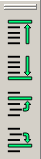
You may have to activate the toolbar with Widgets - Toolbars - Order.
You can lock the layer with the image by the lock icon in the layer list. But there is a known bug that an image, beyond or above a line, blocks the selection of that line for editing, even if the image layer is locked. You have to switch it to invisible.
You can draw above the image, snap works too.