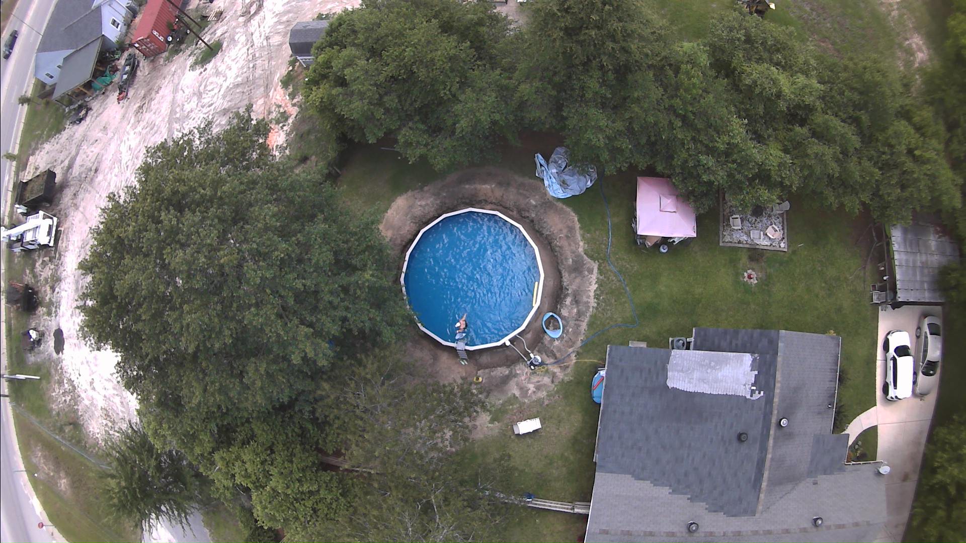
Can I define distances between points in Librecad 2.1.3?
|
Hi, folks. I have an existing JPEG that I imported into Librecad that shows a circular swimming pool in my yard from a drone's eye skyview. I'd like to define the distance from one end of the pool to the other as being 24 feet in diameter so that any other lines and shapes I add to this image have proper measurements. I'm adding possible ideas for a deck and would like to change lines, shapes, etc., with proper measurements on them. Is this possible in Librecad 2.1.3? Thanks in advance. - Bob

|
Re: Can I define distances between points in Librecad 2.1.3?
|
Administrator
|
This is basically no problem. You just have to measure the current diameter of the pool in the drawing and calculate the scale factor. Then scale the image, that you have 1:1 scale or possibly 1:10.
But consider the distortion in the image. The camera optic has a wide angle, the farther the distance to the center is, the bigger is the distortion. Also the height matters. The pool or tents have different scales depending where you measure them, on the floor or on their top. What I would do is to place some poles or stone tiles around the pool in a 30 or 40 feet square for the picture. Then use GIMP to correct barrel and rhombus distortion before the LibreCAD import. But this will be still an approximation and absolutely need some real world proof when the plans are finished. Armin
investing less than half an hour into Search function can save hours or days of waiting for a solution
|
|
Thank you, Armin. Is there a way in Librecad to click 2 points and set the distance between them? I know the actual pool is 24 feet in diameter so I could click a point from one side to the other and set it as 24 feet if such capability exists in Librecad. The distortion from the camera lens is annoying for sure. My plans are rough at this stage of planning, though, so for this purpose I can ignore it. Thank you for the great idea to use Gimp for when I refine the plans. - Bob On Thu, Jun 25, 2020, 2:20 AM LordOfBikes [via LibreCAD] <[hidden email]> wrote: This is basically no problem. You just have to measure the current diameter of the pool in the drawing and calculate the scale factor. Then scale the image, that you have 1:1 scale or possibly 1:10. |
Re: Can I define distances between points in Librecad 2.1.3?
|
Administrator
|
You're welcome Bob.
You can use the info tool 'Distance Point to Point' to measure the diameter after import (menu Tools -> Info). https://librecad.readthedocs.io/en/latest/ref/tools.html#info Then calculate the scale factor: 24 feet / measured diameter And use the tool Modify -> Scale to scale the drawing. To proof, you can measure the pool diameter again. Sadly, there is no one click solution for this.
investing less than half an hour into Search function can save hours or days of waiting for a solution
|
|
Thank you again, Armin. I appreciate your generous help with this! -- Bob On Thu, Jun 25, 2020 at 7:36 AM LordOfBikes [via LibreCAD] <[hidden email]> wrote: You're welcome Bob. |
|
In reply to this post by LordOfBikes
Armin, sorry to bother you again. As far as I can tell, I can modify the scale of elements such as lines, circles, etc. But is there a way to modify the scale of the entire JPEG image showing the swimming pool so subsequent elements added to it are properly to scale with the image? Or perhaps can the entire grid scale be modified if the JPEG image scale can't be modified? I really appreciate your help with this. I need a good hands-on tutorial for LibreCAD 2.1.3 to get better acquainted with it. -- Bob On Thu, Jun 25, 2020 at 7:36 AM LordOfBikes [via LibreCAD] <[hidden email]> wrote: You're welcome Bob. |
|
Have a look at https://dokuwiki.librecad.org/doku.php/usage:tutorials - Measure areas on a map, Solution 2: Rescale your image.
Otherwise do it in Gimp (or whatever package you are using). |
|
Thank you. This is very helpful. Bob On Fri, Jun 26, 2020, 7:35 AM flywire [via LibreCAD] <[hidden email]> wrote: Have a look at https://dokuwiki.librecad.org/doku.php/usage:tutorials - Measure areas on a map, Solution 2: Rescale your image. |
«
Return to LibreCAD-user
|
1 view|%1 views
| Free forum by Nabble | Edit this page |

