Hi all,
I would like to start of by saying that I have never used GIS or CAD programs before, so I am not a pro on this topic. I am researching a suitable software to learn to do below calculation;
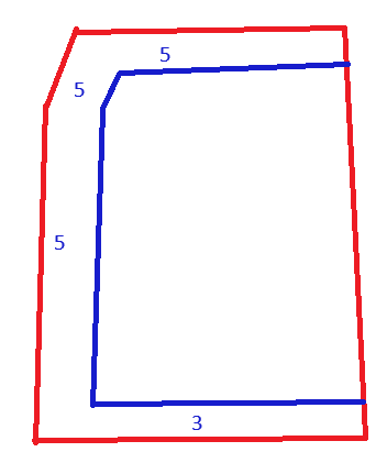
I am getting red polygon from outside source (it is available in many GIS formats like GeoJSON, KML etc). It represents a parcel of land. I want to create blue polygon to calculate its area. Blue area created by offsetting from each side. Value you need to offset can be different for each side of the parcel and I learn those values from another document.
From what I can figure from my limited exposure to qgis software, it is mostly for displaying data on map and analyze that data, rather than make drawings like that.
I was wondering if I could use LibreCAD for this purpose,
Best Regards,
This is a cross post from here:
https://gis.stackexchange.com/questions/498016/calculate-area-after-offsetting-by-different-amounts-from-each-side

